2020 TOUR POSTPONED (SEE BLOG)
FREE JERSEY ENDS MARCH 31ST
ALL PRICE DISCOUNTS END JANUARY 31ST
OUR LOWEST PRICES END DECEMBER 31ST
REGISTRATION OPENS DECEMBER 1ST
We are delighted to share with you the Farmville region!
When you pair beautiful scenery with the warm hospitality, charming home town feel, and variety of terrain, it makes for an ideal bike event location.
Each day of the tour multiple routes are offered, giving you a chance to select something that suits your ability, pace, and preferences. The beauty of Bike Virginia’s format is that you can choose what you want to ride that day, no prior commitment required. You can even take a day off from riding and explore the region or relax at camp.
Our goal is to take you to beautiful views, interesting sites, and historical locations within the host communities. Rest stops (Comfort Stations) will be offered approximately every 20 miles on each route.
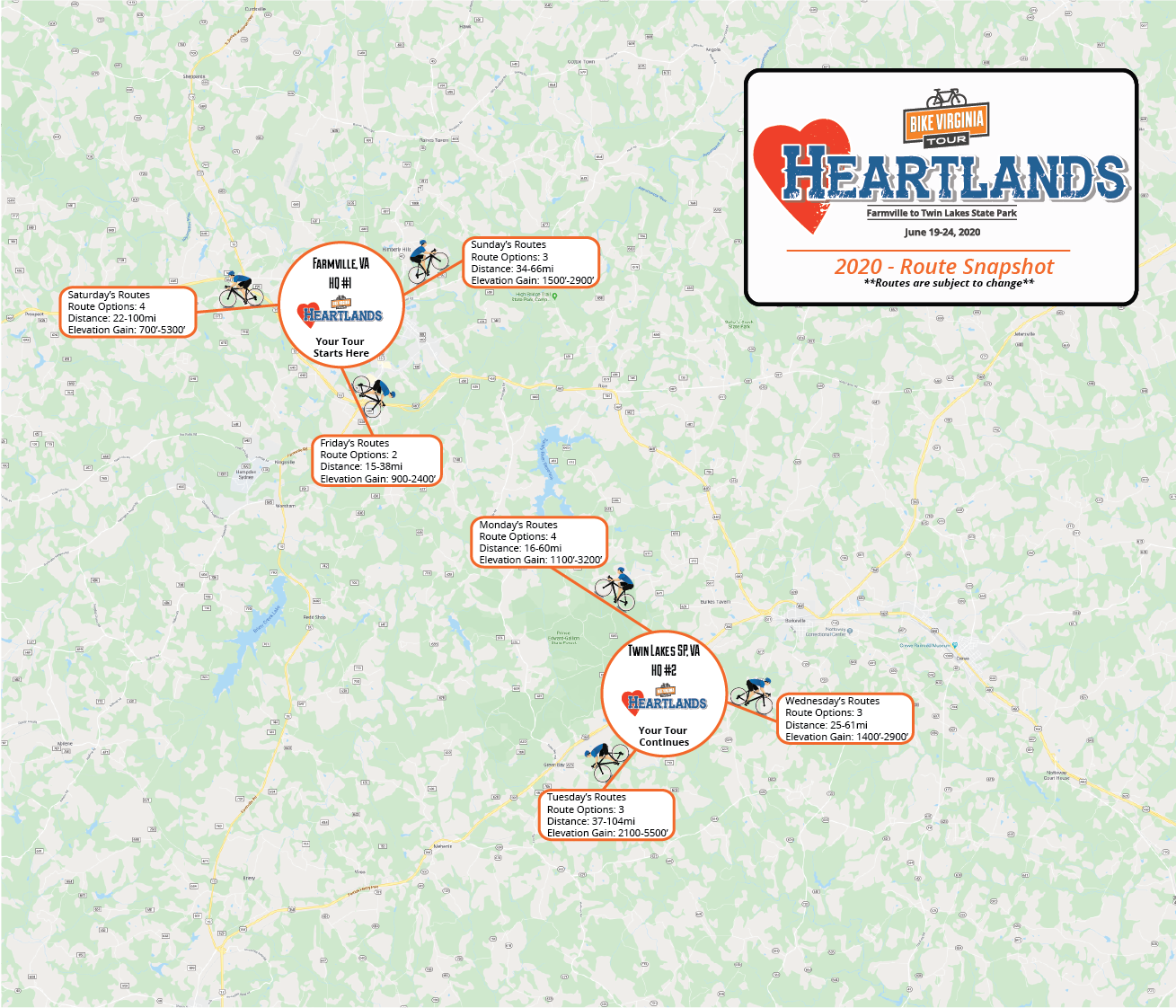
Friday, Saturday, and Sunday (June 19-21) the loop bike routes will be hosted out of Wilck’s Lake Park. Monday, Tuesday, and Wednesday (June 22-24) routes begin and end at Twin Lakes State Park.
In the tables and tabs below you’ll find route overviews for each of the days. Please note that routes can vary as the event approaches as final traffic safety evaluations and road condition evaluations are completed.
The tour is proud to offer riding along the High Bridge Trail for Saturday and Sunday’s routes!
Please see below for a couple of notes when riding the trail.
- Depending on route choice the trail will be part of the start and end of routes on Saturday and Sunday
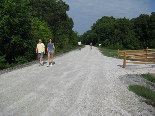
- The trail is made from an old railroad bed
- The trail is mostly flat because of the former railroad grade
- The trail surface is made of finely crushed limestone
- The trail on Sunday traverses over the Appomattox River at bridge height of 120′ above water and length of 2400′
- Puncture resistance tires are recommended
- Smiles optional but Fun!
- Please see the image below for a view of the trail surface
- Click here for more information on the trail itself
Please remember to always follow the signs on the day of the tour. Those will be the most accurate as things can change, even on the day of the ride, so GPS files may not be completely accurate. Signs are your best friend. You will always start and finish your ride at HQ on the Pink Route, no matter which route you choose while riding.
With the exception of the Green Circulator route, all of your routes are signed each morning. The Green circulator route is a short route that sticks close to HQ and we leave those signs up until we move locations. If you want to just cruise around for a mile or two you can do that without getting on the daily routes.
The routes will be open starting at 7:00 am each day (except Friday which will be 12-noon) and will close at 5:00 pm. Getting on the route is up to you as we do not have a mass start; however, we do ask that you depart by 9:00 am to ensure you are back by the time routes close at 5:00 pm.
Every day we will have different route options, varying from 20 miles up to 100 miles! On Friday we offer one route; the remaining five days, multiple routes are available. Choose based on your preferences for distance, the sights, terrain, and points of interest.
Bike Virginia’s Tour events accommodate both recreational and advanced riders. The difficulty rating will be determined closer to the event as routes are finalized. Difficulty will vary daily based on which route option you choose.
Routes are finalized at the Preview Ride in late April. We will assign a difficulty rating to each day of the tour. Route difficulty is rated on a 1-10 scale and is determined by elevation gain (climbing), distance of route, and experience. We will be publishing individual route difficulty for each day. Those ratings will also be printed in the tour guide that you will receive at registration check-in.
TIPS on How to Set up your Bike for this Year’s Tour
After our “preview ride” where we ride all the routes the same day and same time as when you will be riding in June, we created the list below to help you navigate the routes as trouble-free as possible!
BIKE SELECTION
Any bike is ok for the tour as long as you are comfortable riding it. Most riders choose a “road bike” but we have a lot of folks riding hybrid or mountain bikes (with road tires) and even recumbents. The main thing is that you are comfortable and the bike is ready to roll. Below are a few suggestions for this year’s tour with regards to tire selection, gearing and brakes.
TIRES
We recommend using a tire that has a puncture resistant casing such as the Continental Gator Skin or similar tire. Additionally getting a bigger tire such as a 25-28mm or bigger is also a good idea as many of the country roads have some choppy pavement or even a bit of gravel on them. Not having to worry about flats will make your ride that much better and a larger volume tire will absorb more bumps and give you better traction and make for a smoother ride.
GEARING
This area has a lot of hills, some steep and some not so steep but in general you will be happier if you choose a gear that is comfortable for you as you ascend in and out of the New River Valley. If you have a triple chainring crankset you will most likely use the granny gear on some of the climbs. Or if you have a compact crankset vs standard you will be better off using the compact for this years tour. Additionally, running a larger gear combination on the rear cassette will also help when climbing.
BRAKES
Make sure to go over your brakes and ensure they are in good working order. Check the pads, if it has been a while since you last replaced them it may be a good idea to have your local mechanic check them out before getting to the tour. Our on-site mechanics, Shenandoah Bicycle Company and Cycles Ed will be doing free brake checks as well. So if you have any questions about your brakes (or any other part of your bike) please swing by their tents and have them checked free of charge.
THINGS TO CARRY WITH YOU
While the tour is fully supported by our awesome SAG crew, having a few items on your bike will also make for a better experience should you have any minor mechanical issues. Having a spare inner tube or patch kit is great for fixing a flat or to provide one of the SAG folks to assist with changing a flat tire. Don’t forget a pump or some way to inflate the tire and a tire lever so you can remove the tire. A good rule of thumb is to practice changing your tire before it happens—that way you know what to expect should it occur during a ride. A bicycle multi-tool is always good to have for minor adjustments or quick repairs.
LIGHTS
All bikes are required to have front and rear lights. These can be blinking or solid lights. Having lights on your bike helps drivers see you.
Check back later… we’ll have their contact info soon!
Our riders love the 6-day format. We offer 6 DAYS of unique bike routes with only two camp locations. You’ll have more time to relax and enjoy leisurely evenings and mornings without having to pack up your camp. Some bike tours like Ride the Rockies, Cycle Oregon, Bike Florida, and GOBA move up to 5 times in a week! Our riders said they enjoyed more time at each camp and wanted to have their car with them; we listened and built our event around this concept. Two host town locations and 6 DAYS of route choices gives lots of great riding without the hassle of everyday moves. If you’d like to know more, be sure to read about all the exciting changes that come with our unique Double Vision format.
Any route chosen will be a good route; you will have fun and see so many great things wherever your wheels lead you!
DAY ONE
Starting your journey in Woodstock is just the beginning. When you ride out of the tent city campus you will make your way south through the Shenandoah Valley.
Friday is a shorter day and allows plenty of time to catch up with old friends and grab a bite to eat and relax as you plan your routes for the rest of the week!
RED
Distance: 15mi
Difficulty: 2
Elevation: +900'
PINK
Distance: 36mi
Difficulty: 4
Elevation: +1,800’
DAY TWO
As you leave headquarters on Saturday you will quickly find yourself on backcountry roads within the 1st mile. Once you arrive at the first rest stop (Strasburg) you will want to make your route decision. The Red Route heads back to camp, the Pink Route stays the course, and the Orange Route will take you on the Century. Choose wisely 🙂
If you like being surrounded by amazing natural scenery then you are going to love Fort Valley. In fact, Fort Valley is a mountain valley in Shenandoah County. The so-called “valley within a valley” lies between the two arms of the northern Massanutten mountain range in the Shenandoah Valley.
RED
Distance: 35mi
Difficulty: 4
Elevation: +2,000’
PINK
Distance: 56mi
Difficulty: 6
Elevation: +3,400’
ORANGE
Distance: 101mi
Difficulty: 8
Elevation: +5,600’
DAY THREE
There are 4 route choices, each with their own awesomeness.
The Red route will take you for a delightful 15-mile ride before returning you back to camp. Choose the Blue route and you will head out to the first rest stop and then make your way back to camp. Both the Red and Blue routes miss the big climb of the day.
Following the Pink route will take you on a great ride that will almost have you seeing West Virginia as you follow lovely back roads.
If you are feeling your breakfast then hit the Orange route option at the first stop and spend a little more time soaking up the peaceful bliss of the Shenandoah Valley.
RED
Distance: 14mi
Difficulty: 3
Elevation: +800’
BLUE
Distance: 52mi
Difficulty: 4
Elevation: +3,800’
PINK
Distance: 52mi
Difficulty: 6
Elevation: +3,800’
ORANGE
Distance: 64mi
Difficulty: 7
Elevation: +4,700’
DAY FOUR
Move day! This is when you will pack everything up and head over to our next location of Harrisonburg.
Harrisonburg, of James Madison University (JMU) Harrisonburg is full of wonderful things to do and they have a great cycling culture that is full of some of the best riders and riding in the state.
Once you get settled into the new location you will hop on the bike and head back into the valley. Watch out for Amish buggies as you travel through beautiful towns such as Bridgewater, Staunton and even the small hamlet of Stokesville which sits just on the border of the George Washington National Forest.
As you get back into Harrisonburg settle in and relax as you take in your new surroundings.
RED
Distance: 20mi
Difficulty: 3
Elevation: +1,100’
PINK
Distance: 42mi
Difficulty: 5
Elevation: +2,400’
ORANGE
Distance: 68mi
Difficulty: 7
Elevation: +4,500’
DAY FIVE
“If I thought of riding in heaven this is where it would be!”, this is how volunteer Sergei described the routes in this area back in 2010 during the “Knights of the Golden Wheel Tour”. As you can imagine it is really, really great riding. We roll through some of the most scenic and best-kept roads in the valley. Whether you’re in for the full pull of the century or just want to take it easy so you can get back and explore the town, your senses will be overloaded as you pedal along thinking about…well whatever you want to think about 🙂
RED
Distance: 26mi
Difficulty: 4
Elevation: +1,400’
PINK
Distance: 57mi
Difficulty: 7
Elevation: +3,400’
ORANGE
Distance: 100mi
Difficulty: 9
Elevation: +6,400’
DAY SIX
We want you to enjoy the last day of the tour and we feel Wednesday will be one for the record books. Enjoy your last day at Bike Virginia and simply relax as you meander your way back to camp and celebrate your perfect week of riding in the Shenandoah Valley!
RED
Distance: 27mi
Difficulty: 3
Elevation: +1,600’
PINK
Distance: 48mi
Difficulty: 5
Elevation: +2,600’
ORANGE
Distance: 66mi
Difficulty: 6
Elevation: +3,300’
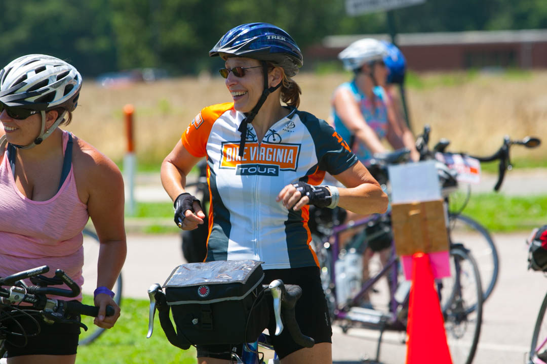
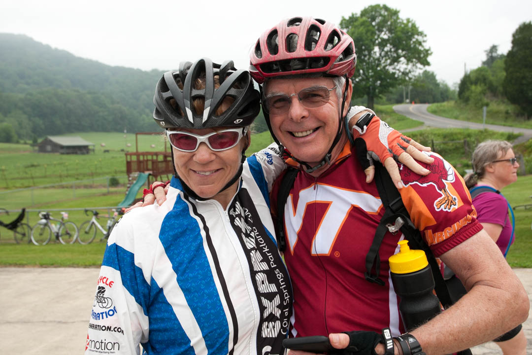
Planning for Bike Virginia’s event includes assessing many factors that affect your riding experience. Several things come together such as our rest stops, permits and various other elements that go into planning roughly 400 miles of riding. We get great local support and advice that help us create a truly memorable riding experience. Location planning takes place over 14 months in advance of the event. During that time we narrow in on the best route options. As spring approaches we work with a large team of volunteers and staff to assess final riding options. Draft routes are published in early spring and final routes are published in the month before the event, due to changing road conditions and service agreements with rest stop locations.
Each button below corresponds to a route option available on the day. Click the button to view the route map, distance and elevation profile. You may also export a GPS-compatible file.
FRIDAY
SATURDAY
SUNDAY
MONDAY
TUESDAY
WEDNESDAY
Please note that all routes are subject to change and approval by local and state authorities. Route maps are hosted offsite by a 3rd party not affiliated with Bike Virginia.
Woodstock (Friday, Saturday, Sunday)
The following small route will remain open for the duration of our stay and can be used for family or super-short rides.
Harrisonburg (Monday, Tuesday, Wednesday)
The following small route will remain open for the duration of our stay and can be used for family or super-short rides.


